Tropical rainforests in the east, high mountains in the middle of the island, dry thorn forests from which baobabs peek out in the west, white beaches and the colourful underwater world of the Indian Ocean, bizarre rock forest, red-brown river bends, villages between rice terraces, tea and vanilla, lemurs, chameleons and smiling Malagasy. Welcome to a tropical paradise of unique beauty – Madagascar!
The largest island in the Indian Ocean and the fourth largest island in the world is also the oldest. As part of India, it was wedged between present-day Africa and Antarctica within the Gondwana continent and became independent very early on, 90 million years ago, resulting in a high degree of endemism. 90% of Madagascar's 200,000 species of life are found only here and nowhere else.
Road 7 - National Parks and local life
Madagascar is a large island with a very underdeveloped infrastructure, so allow plenty of time for your visit and remember that the journey is the destination. Let's first take the only reliably passable, mostly tarmac road 7 south of the capital Antananarivo, nicknamed "Tana".
Mountain villages and a visit to the Malagasy
After four hours we arrive in the town of Ambositra, the centre of the wood-carving area of the Zafimanira tribe. Although the surrounding forests and timber have noticeably diminished, we can still admire the beautiful carvings of shutters, doors and pavilion posts here and in the surrounding villages. On the way south, we turn off at Ivato onto a dirt road leading to the mountain village of Antoetra, nestled nicely among the lush green terraces of rice paddies. There are hiking options on offer, for example to the village of Ifasina.
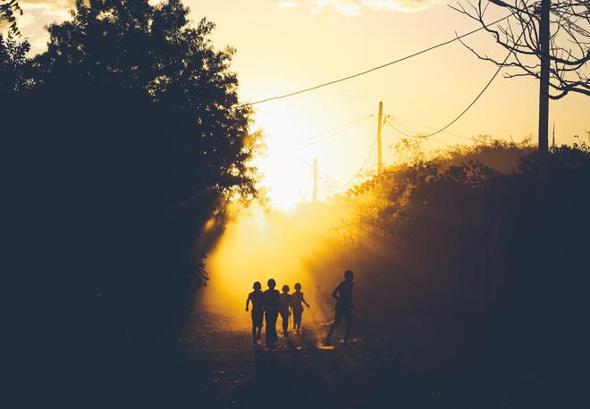
The original inhabitants of Madagascar, the Malagasy, do not originate from Africa, but arrived from distant Indonesia and Malaysia. They brought with them their farming skills and their favourite rice. They began to build terraced fields, bringing water from the mountain streams and rivers. To this day, they toil from morning to night for their livelihood, tilling the fields with incredibly primitive tools, walking everywhere, and most of them have nothing more than an earthen hut. Unfortunately, massive deforestation has occurred throughout history and the land is struggling with extensive erosion. By economic standards, Madagascar is the 11th poorest country in the world. However, the frugal and hard-working people are not starving, and they seem to be unaware of the modern conveniences on which they could spend money unnecessarily. Perhaps that is why they are smiling and give the impression that they lack nothing.
There are eight tribes in Madagascar, all of which have their own dialects and taboos, called "fady". Although the majority of Malagasy are officially Christian, there are remnants of a very strong ancestral cult. The burial rituals are interesting, with graves marked by stone stelae to commemorate the ancestral legacy and to embody a link to the deceased. A local shaman helps to choose a suitable site.
Fascinating is the ritual of famadihana, the turning of the bones. The ceremony of exhuming the dead, where locals remove their dead from their tombs, cleanse them, dress them up and then throw a party full of food, drink and merriment, is unique to the tribes inhabiting the central highlands. We are not likely to come across such a festival, it is held only about every five years, but when it does take place respectful observers may be allowed to witness it.
Ranomafana National Park
Just outside the town of Fianarantsoa, a two-hour drive from Ambositra, we turn into Ranomafana National Park. Its good accessibility makes it the most visited park in Madagascar. It is located on the humid eastern side of the island, where the monsoons coming from the east from India fall, and is therefore covered by a mountain rainforest. This relatively small area has escaped deforestation.
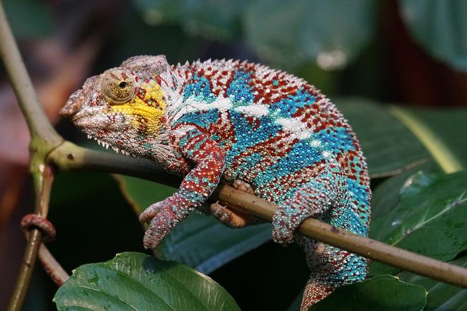
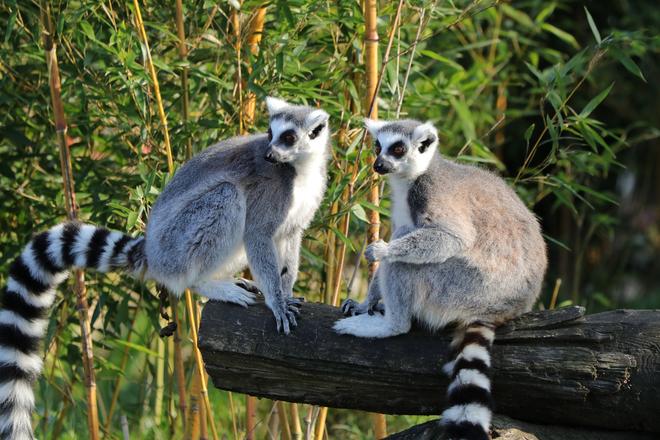
The trips to the mountain jungle here are very well organised. Each group is assigned a guide and a "spotter" who searches for animals in front of the group. We get to see the golden lemur in the bamboo forest, countless waterfalls in deep ravines covered with tree ferns, orchids and lianas, the mighty Namorona River that runs through the park, colourful frogs and chameleons. Some trails lead up into the hills and offer a nice view of the flood of greenery. The highlight of it all is the chance to see some of the lemurs, Madagascar's prosimians of various colours and sizes. Then at night, we see chameleons sleeping, clinging to the thin ends of tree and bush branches to prevent snakes from attacking them. When we shine a torch on the chameleons, they visibly change colour. Some will wake up and roll their eyes at us, but surprisingly, none of them run away.
The train journey or "Mora mora mora"
Fianarantsoa is also the terminus of Madagascar's only railway, the FCE, which runs from the port of Manakara on the east coast. It was built by the French colonialists before the 1990s as a transport artery for goods and sugar cane to the interior, and nothing has changed on the railway since then. Train travel is very popular among the local Malagasy. Perhaps it is more convenient and reliable than transport by truck, it's quite possibly a favourite pastime, but it takes a while to cover any significant distance. We cover only 30 kilometres with a few hours delay and an average speed of 10 km/h. At each station, the train waits until all passengers have bought and eaten the products of local producers before moving on. The spectacular views from the train, the exercise in patience and the very close insight into Malagasy culture are well worth it! "Mora mora'' is a common phrase among the Malagasy people and means "Take it easy, take your time..."
Andringitra National Park: climbing Pic Boby
The starting point for trekking in Andringitra National Park is the town of Ambalavao, a centre of handmade paper production. The women here boil the lye in a cauldron, then pound it with sticks into pulp, which they pour into a sieve. They add tiny flowers to the wet paper to dry it.
The Andringitra massif has a high mountain character. The vegetation gives way to bare rock and we can even feel the cold here. The highest peak of Imarivolanitra, called Pic Boby, is 2658 m and is the second highest mountain on the island. Unlike the tallest, this one is relatively accessible, and it can be reached in a three-day trek. Camping amidst the pristine landscape offers a truly wonderful experience.
Isalo National Park and the western tip of the island
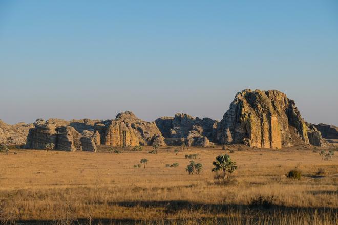
The very accessible Isalo National Park lies just off Route 7, about 700 km from the capital. Here we are already in the rain shadow of the almost 3,000 mountains of the centre of the island. The west of the island is very dry, in some places it rains only a few days a year. In Isalo we encounter plains covered with dry grasses, open countryside with distant sunny views and sandstone cliffs eroded into incredible shapes and deeply incised canyons. It is reminiscent of Arizona's parks or Australia's Uluru.
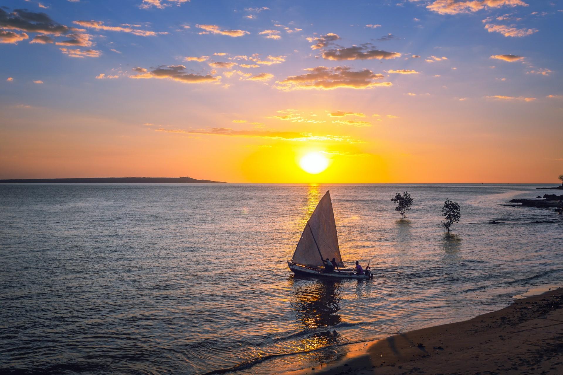
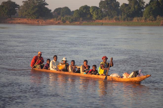
As a reward, after more than a week of exploring all the beauty along Route 7, let's drive down to the sea to the town of Toliara and a little north along the coast to the resort of Ifaty. We'll enjoy snorkelling and diving on the nearby coral reef, or visit the Reniala Nature Reserve, where we'll find the original dense growth of thorn bush – tall scrub from which baobabs peep out here and there. 95% of all life in Reniala is made up of endemics – they are so adapted to the dryness here that they can't survive anywhere else. Evenings in the west coast villages are kitschily beautiful. As the sun sets over the Mozambique Channel, local fishermen come ashore in their wooden pirogues to bring their families their catch. We get the feeling that nothing has changed here for thousands of years, even the wooden boats are still made in the same way and the unbuilt ones resemble whale skeletons.
West Magadaskar – Baobab Alley and Tsingy Stone Forest
Let's now head west of Antananarivo, the wild, inaccessible and most adventurous part of the island. Morondava is easily reached by a comfortable domestic flight from the capital or from Toliara. In at least one direction, let's definitely do it. The overland journey is quite adventurous and even with good road passability, it takes nine hours by rented jeep from the town of Antsirabe. We can make this overland journey more interesting by taking a three-day cruise with the locals on the Tsiribihina River from Miandrivazo to Belo-Tsiribihina, where we will meet the jeep driver.
Baobabs and the famous avenue at Morondava
The roots of the space tree stick up into the sky as if it had come from another planet and stuck its tip into the ground. I blink a couple of times and look again and better: the tree is standing right and the baobab branches arch wide over a trunk as thick as the columns of Egyptian temples.
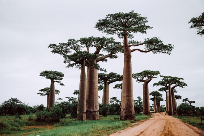
There are six endemic species of baobabs in Madagascar, up to 2,000 years old, and two others in mainland Africa and Australia. They choose tropical areas with longer dry seasons, to which they are fully adapted. The trunk, which has no annual rings due to its high porosity, soaks up huge amounts of water during the rainy season to have reserves for the dry part of the year when it sheds its leaves.
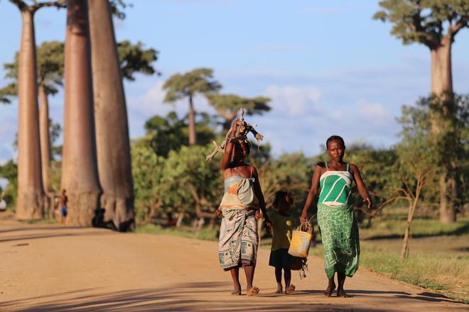
In Madagascar, baobabs grow on the western side of the island, but mostly alone. A grove of about twenty trees scattered around the "main" road north from Morondava to Belo-Tsiribihina provides an interesting view. Through the famous avenue of Adansonia Grandidieri baobabs, Malagasy walk along the choked red dirt from work and school, with only the occasional wagon drawn by a pair of zebu bulls. A few local huts stand among the trees, ready to sell the occasional tourist a wooden statue.
The rock forest of Tsingy de Bemeraha: where to tiptoe
If you're in this remote part of Madagascar, be sure to take the road from Morondava to Belo-Tsiribihina and then on to the village of Bekopaka (another four-hour drive on a dirt road) to see one of the planet's most interesting geological phenomena in Tsingy de Bemeraha National Park. The massive layers of Jurassic limestone here have been gradually transformed by water erosion into a unique karst system. The result is a series of gorges divided by rock spikes up to 100 metres high and decorated with deep scrapes.
It's like a grey castle of rock protecting the most precious thing Madagascar has. Due to the inaccessible terrain, it is one of the best preserved places on the island, where new places and new species of vegetation and animals are constantly being discovered. Here, nature still has its kingdom and it is no wonder that the Malagasy consider Tsingy a sacred spirit area. It's hard not to point fingers at all the wonders: a forest of rock needles and bizarre shapes, all sorts of holes and windows or caves, vegetation including cacti and aloes at the bottom of the gorges, and the occasional lemur, chameleon or lizard.
A part of the vast stone forest is surprisingly well maintained and modernly accessible for tourists and after paying the entrance fee we can take two different guided tours. The paths are equipped with ladders, stepping stones, footbridges and rope bridges, and often involve light climbing, for which rented belays are useful.
North to the sea – coral and vanilla
The northernmost town of Antsiranana can be reached by a domestic flight. From the plane, we'll see the best of Montagne d'Ambre National Park. The volcanic mountain range, covered in rainforest and teeming with all the flora and fauna of the tropics, is crowned with crater lakes, their edges unusually green for a volcano, covered with lush vegetation.
Almost 50% of the world's vanilla is grown in the north and north-east of Madagascar. Its brown to black pods can be bought in whole bunches at every turn. Vanilla pods are the fruit of a tropical liana that was once brought to Madagascar from Mexico. It is of very high quality and its scent is extremely strong.
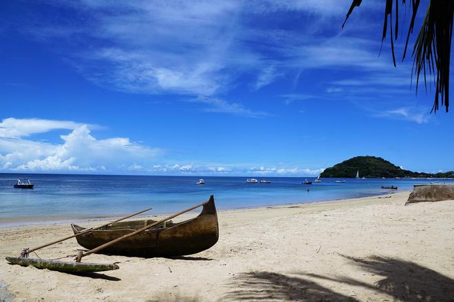
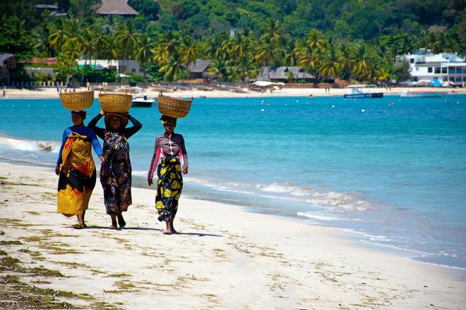
After exploring Madagascar, we certainly deserve a rest on the island of Nosy Be. It's a world-renowned resort that feels like it's been plucked out of the rest of Malagasy reality. Here we can find luxurious and beautifully designed hotels, sandy beaches, azure seas and corals that can be reached by cruise boats for snorkelling.
